Will Bailey: When Federal Maps Erase Rural Hawaiʻi
The U.S. Census Bureau has changed what is classified as “urban” and “rural.” That can have major economic ramifications.
November 7, 2025 · 6 min read
About the Author

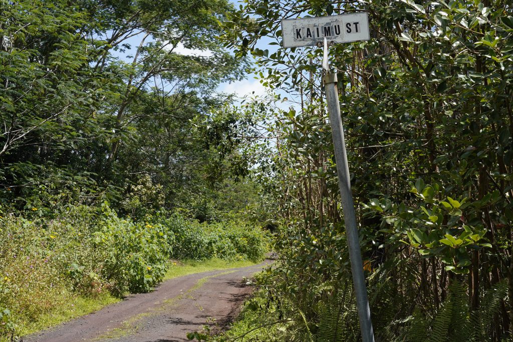
I never thought of this part of Puna as an urban center. In fact, I might have scoffed if I’d ever heard it called one — like a sunburned gas-station attendant in a road movie, laughing at the idea of city limits.
There are still enough loose dogs to keep you alert, though it’s gotten better in recent years. There was a time I might’ve wished for a semester or two of canine psychology just to finish a jog without a turnaround or reroute.
Over the last two U.S. Census counts, neither my father nor I — we live in the same neighborhood — ever saw an official census taker. Many neighbors have said the same.
And yet these streets sit in a patchwork of areas that federal programs rather haphazardly now recognize as either “urban” or “rural.”

Ideas showcases stories, opinion and analysis about Hawaiʻi, from the state’s sharpest thinkers, to stretch our collective thinking about a problem or an issue. Email news@civilbeat.org to submit an idea or an essay.
The confusion starts in Washington, not here.
In 2020, the U.S. Census Bureau quietly changed how it defines what counts as “rural.” It eliminated the category once called “urban clusters” — the middle ground that covered small towns and remote communities — and replaced it with a single “urban” designation for any area with 5,000 people or 2,000 housing units.
On paper, that simplification looked harmless. In practice, it redrew the map of who qualifies for help.
‘The Cost Of Isolation’
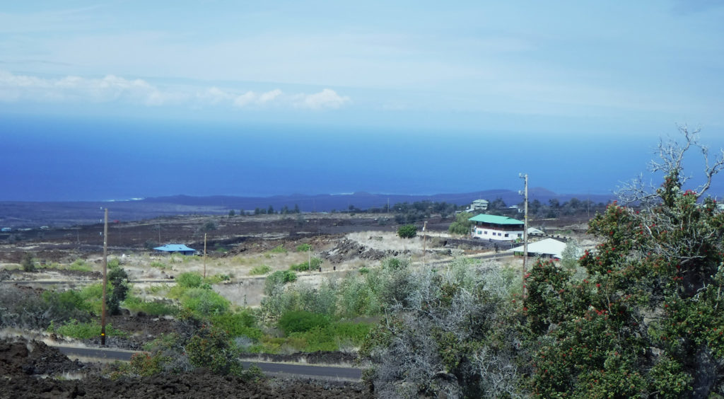
Across Hawaiʻi island, districts like Puna, Hāmākua and Kaʻū shifted classifications. Some areas that once sat in the gray zone became fully rural. One, Hawaiian Paradise Park, tipped to urban. The lines changed, not the reality.
Technically, rural territory nationwide increased — millions more acres now qualify on paper. But the middle disappeared. By erasing the “urban cluster” category, the census turned a nuanced map into a binary one: city or countryside, urban or rural — though on the ground, some communities now straddle both.
Under the new criteria, “urban” no longer means city life. It means density on a spreadsheet.
Kaʻū is mostly rural on paper now — Discovery Harbour, Ocean View, Nāʻālehu — but one side of a road can access USDA broadband grants while the other cannot, because programs use ZIP codes or census-designated places, not reality.
A state Department of Business, Economic Development and Tourism report warned years ago: federal rules “do not reflect island geography or the cost of isolation.”
They still don’t.
The Census Bureau didn’t set out to erase rural Hawaiʻi. It just changed the definitions — assuming the data would trickle down cleanly into every corner of the country.
But those corners aren’t flat. They’re lava rock and gulch, rain forest and cinder cone. The geometry of this island doesn’t fit the mainland template.
And yet that’s the framework federal agencies use to decide where aid lands — housing, food, broadband, agriculture. What looks like simplification in Washington becomes distortion here.
A neighborhood that hauls water, runs on solar and drives 45 minutes to mail a letter is not “urban.” It’s a reminder of what gets lost when distant systems define local reality.
If a community doesn’t fit the categories, it disappears between them. That’s the vanishing line, not just on a map, but in the way resources flow, policies form and stories get told.
The Cost Of A Miscount
When the classifications changed, the money followed.
State economic analysts estimate Hawaiʻi forfeits $30 million to $50 million each year in rural-aid eligibility — broadband, agriculture, housing and public-health programs among the losses. DBEDT has warned of similar gaps since 2018 – even before the census reclassifications.
At Puna Community Medical Center, spotty internet still disrupts telehealth calls. Kaʻū Rural Health Center struggles with staff shortages and aging equipment. And along the Hāmākua coast, small farming co-ops have watched grants vanish mid-cycle when even the rural designation fails to unlock aid for their ZIP code.
If Washington wants clearer data, it should start by seeing what’s really here — communities that count, whether or not the map says so.
It’s not neglect in the moral sense — it’s neglect by spreadsheet. The federal formula recognizes growth, not geography.
Even Hawaiian Paradise Park — now federally “urban” despite catchment, no sewer, and 45-minute drives to basics — stands in stark contrast to Fern Acres, now “rural” on paper and still off-grid.
“They just keep building more houses without the infrastructure to support more people,” said Melissa Nicholson, who lives in Hawaiian Paradise Park. “The traffic is bad now, let alone when those new houses are filled.”
Two neighborhoods, opposite federal labels — but both erased in practice.
Another Hindrance To Help
And that’s just the map. The deeper cut is what happens when even the right programs stay hidden.
The census map isn’t the only thing erasing rural Hawaiʻi — there’s also bureaucratic isolation.
State Rep. Matthias Kusch, a former firefighter and marine ecologist, sees a silo effect.
“There are at least two county entities, one private, and one state program working on cesspool conversion independently, in separate rooms with the doors closed,” Kusch said. “Nobody knows the other exists.”
But his favorite example is the North Shore Economic Vitality Partnership, a nonprofit that helps small farmers get USDA-certified through a mobile system that streamlines recordkeeping and compliance.
“Unless you’re already in the farm network, how would you ever find it?” he said.
There are ways to fix all this. Federal agencies could follow the lead of the Office of Rural Health Policy, which in 2024 began using a “road ruggedness” scale to account for isolation in health-grant eligibility.
Similar adjustments in USDA and broadband programs could restore fairness for remote islands.
Better enumeration partnerships — hiring local fieldworkers who actually reach off-grid neighborhoods — and an appeals process for misclassified census designated places would help too. Because no algorithm can see the distance between a map and real life.
If Washington wants clearer data, it should start by seeing what’s really here — communities that count, whether or not the map says so.
Correction: An earlier version of this story misstated the role of the North Shore Economic Vitality Partnership.
 Sign up for our FREE morning newsletter and face each day more informed.

Local reporting when you need it most
Support timely, accurate, independent journalism.
Honolulu Civil Beat is a nonprofit organization, and your donation helps us produce local reporting that serves all of Hawaii.
ContributeAbout the Author