

Kevin Kuramoto is tired of shoveling mud and wheeling away piles of dirt.
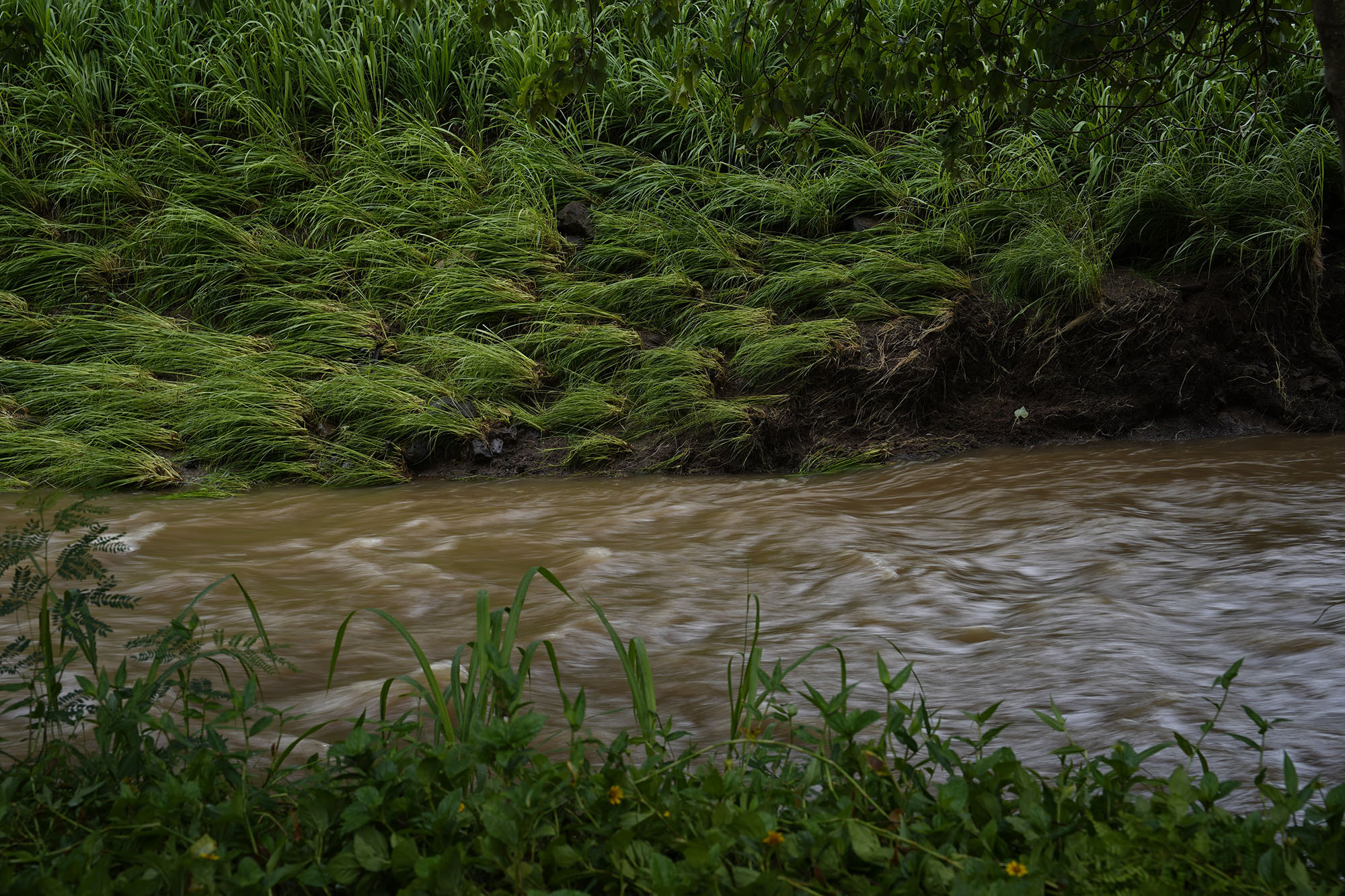
The groundskeeper of the Agape Christian Fellowship in Pearl City and church leaders had just finished cleaning debris left behind by the Kona lows in March when Hurricane Lala hit, swelling the nearby Waiawa Stream and inundating parts of the church property under 4 feet of water.
Church leaders struggle to recall how many times the property, tucked into a rural corner of otherwise urban Pearl City, has been inundated. What they are certain of is that the flooding is getting worse.
State officials have known of the potential damage the stream could cause for more than 60 years. But, like many of the waterways that contributed to more than $1 billion in damages across the state in March, it was never fixed.
Following the Kona low storms, Civil Beat identified nearly a dozen flood-prone and poorly maintained streams that contributed to flooding or directly caused storm damage during the Kona lows.
Though each stream had its own backstory, they revealed a common problem across Oʻahu: warnings from residents about flood dangers went unheeded and long-term plans to control floods were often left unfinished.
Over the decades, officials have approved funding for studies only to allow them to languish so long they become out-of-date or toss aside the conclusions, deeming them too expensive to implement.
Flooding has proved expensive to control. In the last 20 years, the Legislature allocated about $92 million to flood control studies and projects across the state, a Civil Beat review of budget records found. Lawmakers separately put $22 million during that same time period toward rockfall and flood mitigation.
“They know this is a problem,” said Mānoa resident Cookie Shimizu, who saw torrential water flood the banks of the Mānoa stream earlier this year.
No single entity in the state oversees stream maintenance and management, according to William Aila, former head of the state Department of Land and Natural Resources. Enforcement is often left to an alphabet soup of government agencies.
“It can get very complex,” Aila said.
On Oʻahu, the city’s Department of Facility Maintenance is responsible for city-owned streams and enforcing maintenance responsibilities on owners; the Commission on Water Resource Management regulates water flow standards and stream diversion; state agencies that are land owners are usually responsible for streams that are on or run through their land; the state Department of Transportation maintains bridges and the portions of streams and rivers that run directly beneath them.
And which agency gets involved depends on the issue at hand.
“Is it inflow issues? Is it guys dumping rubbish? It’s all based on what the facts of the issue are,” Aila said.
Though most of the flood coverage on Oʻahu has focused on the North Shore, the poor maintenance of streams is an islandwide issue — one that could be magnified this hurricane season as warmer ocean temperatures could lead to more hurricanes in the Pacific.
Here are eight areas Oʻahu residents should be aware of.
Waialua
Kaukonahua

Kaukonahua stream begins high up in the Koʻolau range, flows through Lake Wilson and down into a ravine that runs from Wahiawā to Waialua. It has numerous owners along the way, with the city owning one section of the stream just past a bridge on Farrington Highway near a Waialua neighborhood.
For years, the city did not maintain the section it owns as islands of sediment and trees clogged the stream — despite spending $450,000 on flood studies — leading to some of the most damaging flooding during the Kona low storms.
The city and state cleared clogged sections of the stream, work previously deemed infeasible, after the floods. Routine maintenance, upstream measures like detention basins, and better land management at higher elevations would be required to prevent floods in the future, according to past studies.
Lāʻie
Wailele
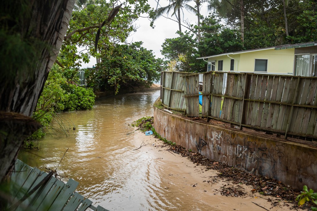
The Wailele stream behind the Brigham Young University campus in Lāʻie has overflowed causing damaging floods at least 13 times since 1897.
In March, the water again went over its banks, flooding BYU’s campus and homes and streets in Lāʻie, which has just one culvert behind Foodland that can drain water. The water came without warning, as there are no stream gauges in Lāʻie to alert residents to rising water levels.
Seventy homes in Lāʻie reported at least some storm damage, according to city data. Some homes required upwards of $100,000 in repairs, according to residents.
The stream as well as the watershed that feeds it — and much of the land in Lāʻie — is owned by the real estate arm of the Church of Jesus Christ of Latter-day Saints. In 2021, the City and County of Honolulu approved plans to prevent floods by diverting portions of the stream. Hawaiʻi Reserves Inc., which handles the church’s real estate in Hawaiʻi, offered to help share costs with the city. But those projects stalled in the last five years as cost estimates came back higher than expected, requiring the U.S. Army Corps of Engineers to go back to the drawing board, according to council member Matt Weyer.
The City Council has now funded a new flood study in partnership with the Army Corps.
Koʻolaupoko
Waikāne and Waiāhole
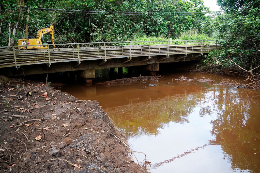
Water from the city-owned Waikāne Stream spilled into the Kamehameha Highway in March, where the river takes a sharp turn near the Waikāne Store. Banks of the Waiāhole River, parts of which are owned by the state and leased to farmers, often overflow near the Waiāhole Poi Factory.
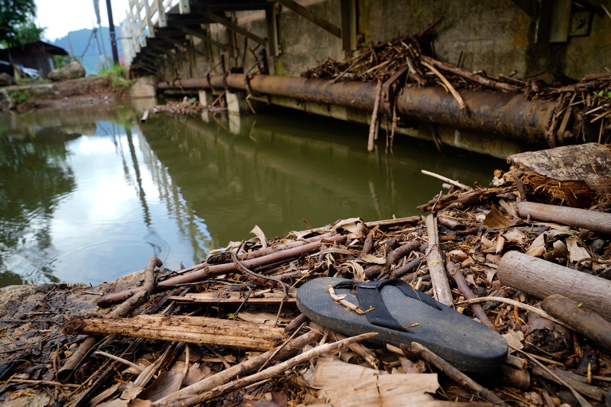
Nearby farmers reported downed trees clogging various points of both streams before the Kona low storms that exacerbated flooding in those areas. City and state crews cleared the streams after the storms.
The City Council earlier this year did not approve a $5 million request for flood control projects in the district that includes those streams.
Wailupe
Wailupe Stream
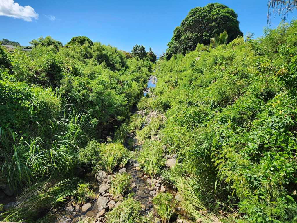
The state and federal government spent upwards of $500,000 on flood studies for Wailupe Stream throughout the 1990s, after a devastating New Year’s deluge across Oʻahu in 1988, according to newspaper reports. But flood mitigation efforts for this stream ended in 1998 after the federal government determined projects did not have enough “positive net benefits.”
Flooding in 2018 spurred a new round of studies to prevent similar damage in the future. The stream is owned by the city and was clogged with overgrown grass during the Kona low storms, heightening fears that it could flood again. Though widespread flooding wasn’t seen this year, the city’s facility maintenance department cleared the stream in April at the urging of Council Chair Tommy Waters.
Two years ago, the City Council allocated $3 million for a flood control study for the Wailupe watershed, which the Army Corps is currently conducting.
State lawmakers earlier this year also put another $500,000 toward a flood mitigation study for the stream.
Mānoa
Mānoa Stream

A “wall of water,” as one resident described it, flooded the Mānoa Marketplace and residences near Woodlawn Drive in March. Flooding was attributed to debris that clogged the stream underneath the Woodlawn Drive bridge despite a project in 2018 that widened and deepened the stream channel under the bridge.
In the mid-1990s, a flood study recommended lining the downstream channel with concrete and making other improvements to handle a “100-year flood,” a major flood event that has a 1% chance of occurring every year. But the report said community groups wanted to keep the stream as natural as possible, so the project was never implemented.
City contractors cleared the stream ahead of Hurricane Lala, part of a larger effort to improve drainage.
Pearl City
Waiawa Stream
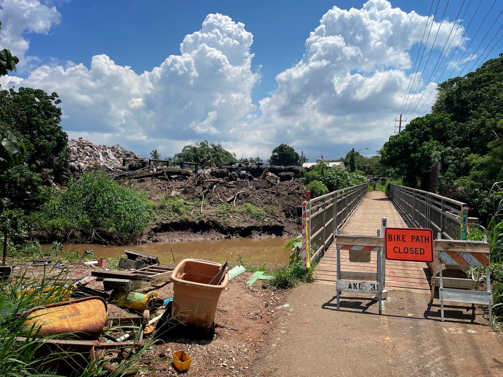
The city undertook a massive project to control streams in Pearl City and ʻAiea after a series of deadly and damaging floods in the 1950s and 1960s. However, despite proposals for $3.8 million worth of flood control projects for that stream alone, Waiawa did not see significant improvements like concrete lining or widening that the other streams received.
The stream has flooded the Agape Christian Fellowship Church and surrounding farms and other properties at least nine times in the last 11 years, according to assistant pastor Ron Kaua.
The state owns a portion of the stream that runs by the church, Kamehameha Schools owns another section past the Pearl Harbor Bike Path, and the city owns the final stretch of the stream before it empties into Middle Loch.
The waterway is choked with mangroves at several points, but church leaders and other residents believe the primary culprit is a bridge downstream that hangs low over the water and becomes dammed with debris, blocking water from passing through. News accounts from past floods between 1956 and 1992 show residents had raised concerns about blockages in the stream then, but little was done to implement long-term flood control measures.
The state cleared the stream after the Kona lows, but it became clogged again during Hurricane Lala.
Mākaha
Mākaha Stream
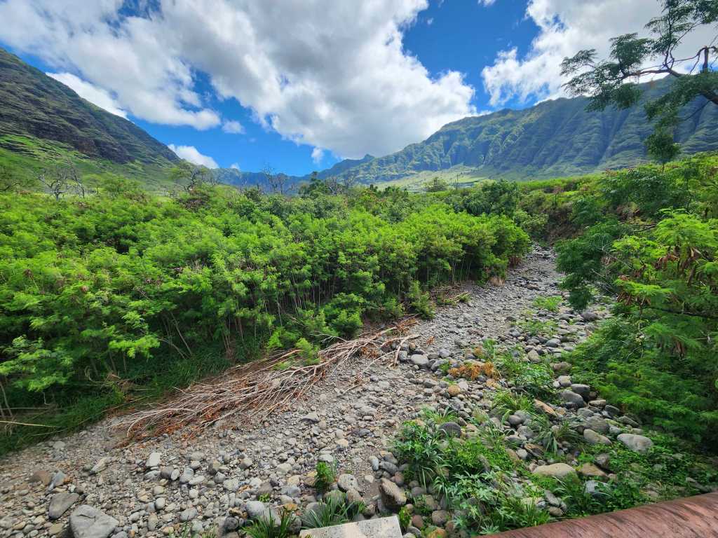
Ranching, sugar cane and then resort developments altered the natural path of Mākaha Stream to what it is today.
More than a decade ago, a study commissioned by the Legislature recommended spending at least $38 million to shore up flooding in Mākaha. The study called for drainage improvements on Noholio Road, a levee around the Mākaha Stream, detention basins to reduce flood risks, and channel improvements to Eku Stream on the Waiʻanae-side of the valley.
While the Mākaha stream mouth was widened and lined with concrete, most other projects were not funded.
In March, the entrance to Kili Drive became a pond and its upper elevations, a river. Residences near Lahaina Street had about 6 inches of water in their yards and under their homes.
The flood study from 2014 noted that finding an entity to implement some of the recommended mitigation measures could be difficult because the streams in Mākaha and land surrounding them are privately owned.
Further up the coast, parts of Makaua Street flood because of poor drainage in the area. Funding to repair a drain in the area to alleviate that flooding was not included in the final draft of the city’s latest budget.
‘A ton of issues’

Following the storms in March, many of the streams that caused problems across Oʻahu were cleared. Some, like the Mānoa stream, were cleared again before Hurricane Lala. The City Council earlier this year also allocated funds to the Honolulu facility maintenance department to acquire another long-reach excavator, bringing the total to three, to maintenance crews can service more areas.
Over the last decade, proposals to address systemic issues with streams have failed to advance in the Legislature, including bills to transfer stream maintenance responsibilities to the state, authorize emergency workers to clear problem streams ahead of storms, including those on private property, and remove invasive species in flood-prone areas. Most bills dealing with stream management died without ever getting a hearing.
The House convened a working group of about 20 lawmakers after the Kona lows to generate proposals to better manage streams ahead of the next legislative session in January.
“We have a ton of issues to work through,” Rep. Amy Perruso, a member of the working group, said.
Perruso, whose district includes parts of Waialua and Mokulēʻia that saw flooding, plans to introduce a bill to put responsibility for stream maintenance back on the government rather than dividing that responsibility up between private owners and various government entities, as it is under the current law.
She also said Hawaiʻi needs updated hydrology maps that take into account how development has diverted the natural flow of water. She wants lawmakers to finally act on flood and stream issues.
“Hopefully we can at least emerge with some changes to law and changes to policy that will reassure my community and help rebuild trust in government,” she said. “Right now, it’s pretty low.”
Lawmakers last session allocated $300,000 for stream stewardship and $800,000 for mangrove removal statewide.
While that could help in the short term, it’s not nearly enough to address the gaps in flood control that led to this year’s disaster. Earlier this year, the Honolulu City Council weighed a proposal to spend $58 million for flood control measures just for the North Shore and Windward side of Oʻahu.
The council approved roughly $3 million instead to more flood studies for those areas and a requirement that the city set up a maintenance plan and timeline for stream clearings.
Pearl City lawmakers told the area’s neighborhood board in May that some of the newly allocated funds in the state budget could be a starting point to better manage Waiawa Stream, but that management of the entire watershed needs to be taken into account to reduce flooding in the future.
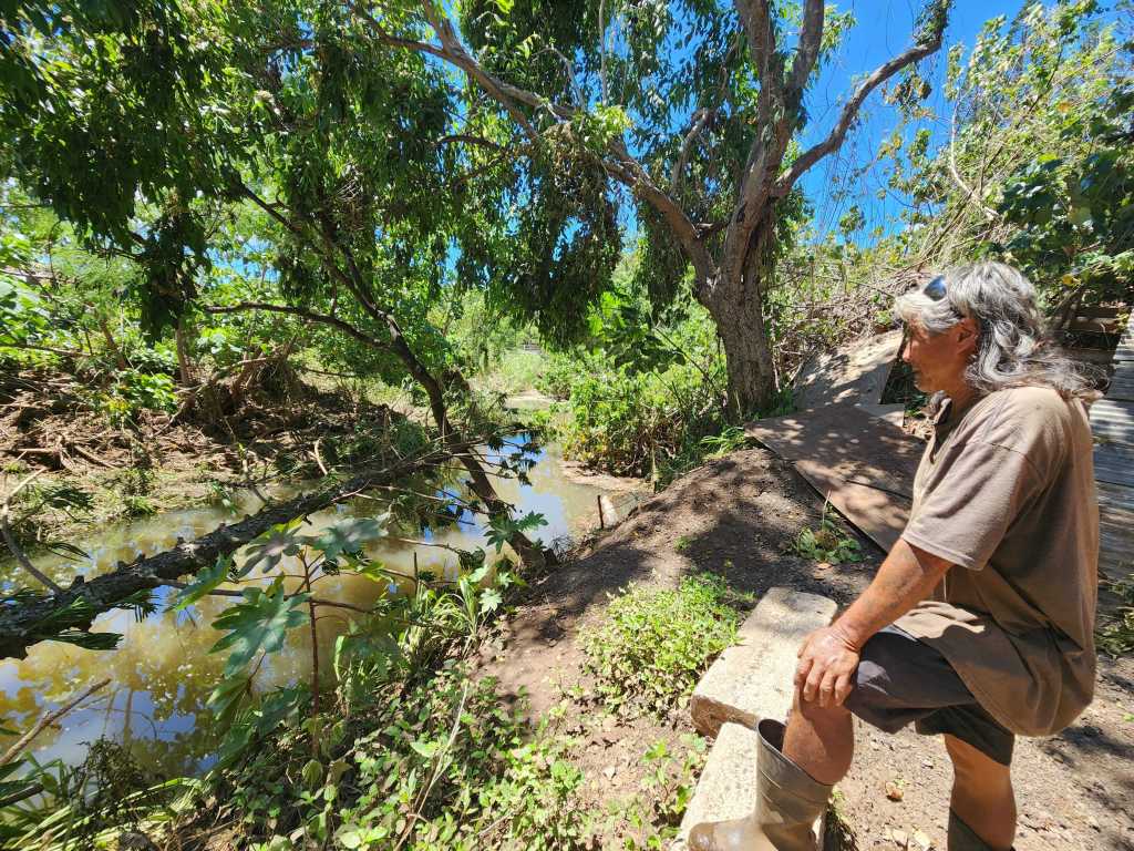
Talk like that means little to people like Kuramoto, the groundskeeper at Agape Fellowship in Pearl City. Looking down into the murky, stagnant Waiawa Stream – where he can almost see the blockage through the weeds downstream – Kuramoto says it’s hard to get attention from government officials when you aren’t politically connected.
The church is moving critical equipment to higher ground and looking for ways to backfill the land, elevating it higher above the stream and making it less prone to flooding.
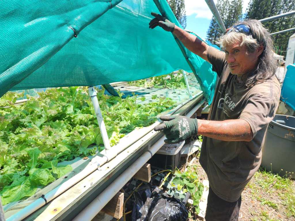
The church runs programs for at-risk youth and has an aquaponics farm that the youth take care of to earn money from sales to local businesses. It’s those programs and the youth they serve, the pastors say, that keep them going in spite of the floods.
“The good,” Kuramoto said, pointing to a new crop of green lettuce, “always outweighs the bad.”
