Honolulu Officials In 2004 Had A Vision Of The City In 20 Years. The Reality Looks Much Different
As the city updates its development plan for urban Honolulu, officials hope to achieve more goals than they have since the last update.
The City and County of Honolulu is updating its development planning document for the island’s primary urban center, which stretches from Pearl City to Kahala.
More trees, better beach access and more income-restricted housing units are some of the goals included in the proposed plan, which was published in October as a colorful packet more than 330 pages long.
That vision is an update to the plan published 20 years ago. Then, city planners imagined what Honolulu in the year 2025 could look like.
Pearl City and Liliha streets teem with vibrancy in the 2004 document. A park in Kakaako is well-used and surrounded by housing. Downtown, people walk along a beautiful and accessible waterfront. The city’s Lei of Parks is connected by pedestrian and bike paths.
So how did it do?
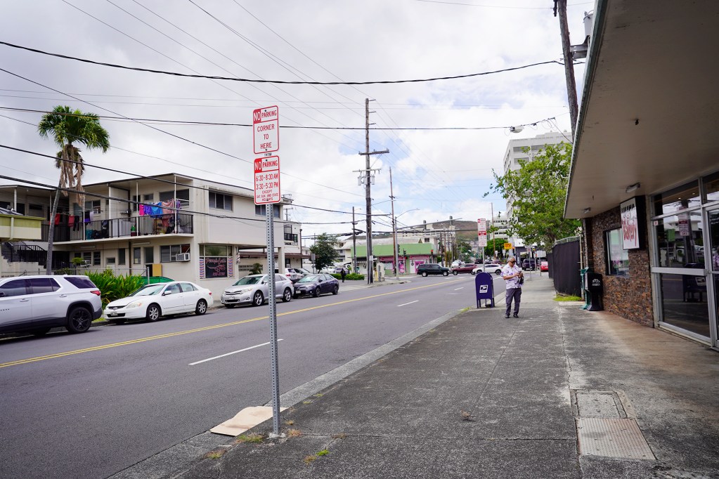
“A lot of the things that were talked about as kind of nice shiny objects in the 2004 plan never came to be,” council member Tyler Dos Santos-Tam said at a council meeting in June.
That meeting was focused on the newest version of the plan. But Dos Santos-Tam questioned who would be in charge of ensuring it is followed, pointing out that many items in the 2004 version fell through the cracks.
“That follow-through did not happen with the last iteration of this plan,” Noelle Cole, head of the Department of Planning and Permitting’s Policy Planning Branch, said at the meeting.
Cole said that changes will happen this time through the council’s update of the island’s expansive Land Use Ordinance, which council member Esther Kiaaina is leading over the course of months of hearings on things like housing, wind turbines and agriculture.
Waterfront Access
The City Charter mandates a general plan for Oahu along with eight community plans, including the one for the urban center. Ben Lee, the city’s managing director until the end of 2004 under Mayor Jeremy Harris, said the document isn’t often followed to the letter.
“It’s a vision,” he said.
A central theme in the 2004 plan was giving residents more access to Honolulu’s waterfronts.
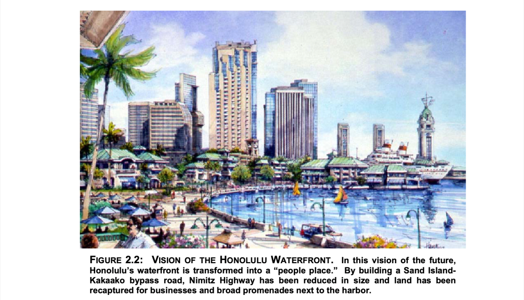
Beach access is part of that, but it also included areas like Pearl Harbor, the downtown waterfront and the city’s numerous streams.
Nimitz Highway and Ala Moana Boulevard, both under state rather than city jurisdiction, make ocean access cumbersome for pedestrians, the 2004 document says.
“While the waterfront is within short walking distance of activity centers in Chinatown, Downtown and, increasingly, Kakaako, the design of and operation of Ala Moana Boulevard — and especially Nimitz Highway — discourage pedestrians from crossing these thoroughfares,” the 2004 document says.
To combat this, the document describes a plan to shift Nimitz Highway to Sand Island, where it would then tunnel under Honolulu Harbor and resurface around South Street. That would allow the city to convert the highway’s current location along the waterfront into a wide promenade for pedestrians and businesses, similar to what Boston did during its ambitious Big Dig project about 20 years ago.
“As demonstrated in leading cities throughout the world, recapturing visual and physical access to the urban waterfront can stimulate economic renewal and be a source of civic pride,” the plan says.
But the Sand Island Bypass never happened. And with development of the city’s overbudget rail project Skyline consuming much of the past 20 years, Lee thinks that the public doesn’t have much appetite for additional projects of that magnitude.
“A lot of that is going to be O.B.E. — overcome by events — because Mufi Hanneman basically proposed the transit,” he said.
The rail project was expected to cost $5.2 billion but is now estimated at almost $10 billion. Boston’s Big Dig also ran significantly over-budget, in the end costing almost $15 billion compared to its initial $2.6 billion estimate. A 1999 article in Pacific Business News cites an estimated cost of $400 million for the Sand Island Bypass.
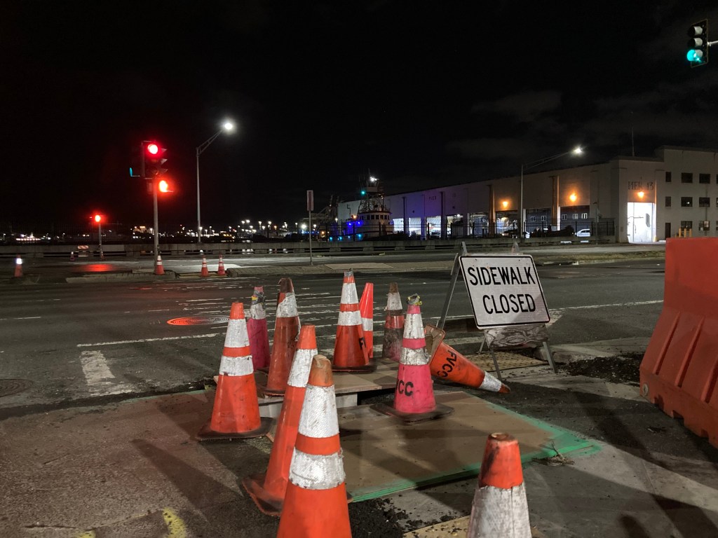
Nimitz Highway and Ala Moana Boulevard remain essentially as they were in 2004, though the state is building a pedestrian walkway over Ala Moana Boulevard that is scheduled to open in September, KHON2 reported.
Zoning Reform
Another goal was to promote a more active street life.
In one rendering, Lehua Avenue in Pearl City sports shaded sidewalks and plentiful storefronts. People sit outside and chat at tables.
“That did not happen,” Larry Veray, chair of the Pearl City Neighborhood Board said.
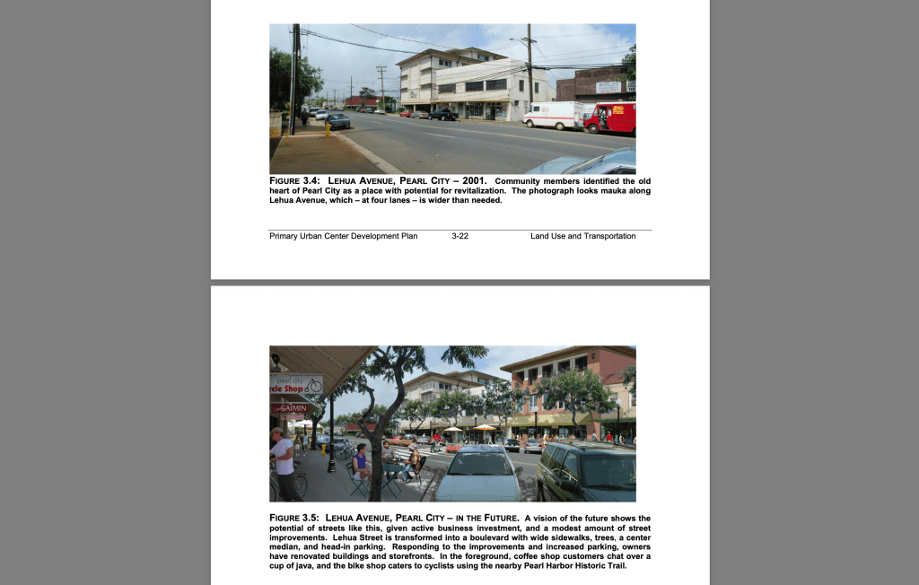
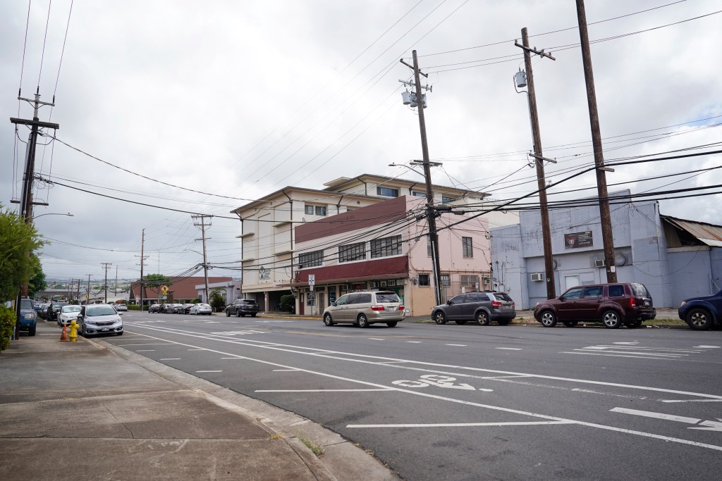
The ground floor businesses that were predicted to proliferate have not done so, partially due to a lack of zoning reform.
Zoning is one tool planners use to determine how a city is built. Areas can be zoned for housing, businesses or both, for example.
Mixed-use neighborhoods that combine both housing and business are in vogue. Advocates argue that residents should live close to businesses so that they can easily walk places, enlivening neighborhoods.
On the council, Kiaaina is hoping to amend the island’s Land Use Ordinance to allow housing in districts where only businesses are permitted, like along Kapahulu Street and in Kaimuki along Waialae Avenue.
And Mayor Rick Blangiardi wants to develop Iwilei into a mixed-use neighborhood, which requires changing state law so that the city can get financing to do so.
But zoning reform isn’t enough.
Trey Gordner, data science researcher at the University of Hawaii Economic Research Organization, said that pro-development groups often point to zoning reform as one of the key mechanisms for achieving their goals.
“That is true — to some extent — but it relies on the developers. And the developers rely on the profitability, the financing, what people actually want out in the world,” he said.
These other factors can be powerful motivators. For example, the city stopped mandating the construction of a minimum number of parking stalls in its primary urban center in 2021, part of the 2004 plan. But developers continue to spend tens of millions of dollars on parking structures because of market demand.
And even if a city reforms its zoning laws, the cityscape only changes at the pace of development, which has booms and busts.
Lei Of Parks
The city intends to connect its urban Honolulu parks like Kapiolani Park, Old Stadium Park, Ala Moana Beach Park and Kakaako Waterfront Park through a series of shared-use walking and biking paths, a concept it calls the “Lei of Parks.”
Some progress has been made, but the plan has not yet been fully realized.
“That’s still a thing we’d like to see more focus on,” Hawaii Bicycling League Executive Director Travis Counsell said.
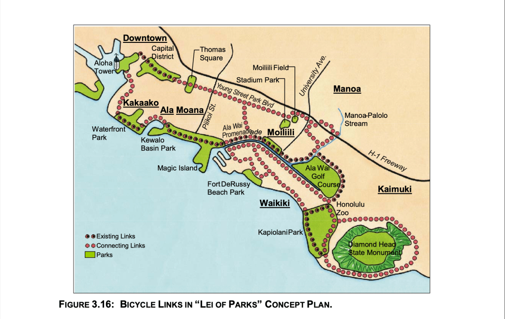
Almost none of the proposed links in the 2004 plan have been built, a notable exception being the mauka side of Kapiolani Park. While some bike lanes exist, like along Ala Wai Boulevard, advocates prefer safer shared-use paths that keep them physically separated from car traffic, and those are the kinds of paths the plan proposes.
Blangiardi has said that he is not in favor of a protected bike path along Ala Wai Boulevard. But Counsell thinks that constructing a proposed bike and pedestrian bridge over the Ala Wai Canal — “in whatever capacity it is” — will help drive demand for more substantial bike infrastructure in the area.
Some infrastructure improvements are just different from what the 2004 plan proposed.
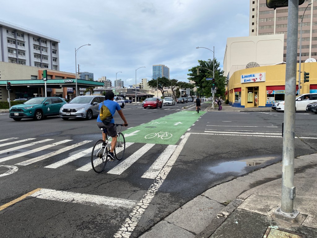
Instead of a park-like bike-only boulevard along Young Street, for example, the city constructed a two-way protected bike lane one block away along King Street.
“Sometimes political leadership — whether that’s a mayor, or governor, or even some specific elected officials — might have a project that they are passionate about, and that gets prioritized … and sometimes that’s a really great thing,” Counsell said.
Former mayor Kirk Caldwell heavily promoted the King Street bikeway, which better connects the University of Hawaii Manoa to downtown, and many bicyclists were already using King Street, according to an explanation given to the Diamond Head Neighborhood Board in 2014.
Counsell said that the city has so far constructed safe and extensive shared-use paths in some areas, like next to the Ala Wai Golf Course along Date Street and along Kapahulu Street next to the zoo. But the lack of connection between those paths prevents Honolulu’s bike infrastructure from being a viable network for everyday transportation.
“It’s like a highway that ends in a field or a parking lot or something. It’s like, yeah, you could bike or drive across that — but how nice would it be if everything connected?” he said.
The council will host meetings to discuss the plan’s next iteration at Moanalua High School Library on Tuesday; at Kaimuki High School Auditorium on Aug. 12; at Leeward Community College Theater on Aug. 14; and at Kawananakoa Middle School Cafeteria on Aug. 15. All meetings will run from 6 p.m. to 7:30 p.m.