Rumored Lala ‘Dam Burst’ Was Likely Invasive Trees, Officials Say
Kaʻū residents are bringing a new level of scrutiny to the hills above Nāʻālehu after Hurricane Lala prompted questions about the aging water systems above the town.
In the two weeks since Hurricane Lala brushed against Hawaiʻi island, social media has been filled with rumors of a burst dam, reservoir or other water containment structure in the hillside above Nāʻālehu. Thousands of people have shared social media posts with differing theories that come to the same general conclusion: the sudden surge of water that rolled down the mountain on the evening of Aug. 15 couldn’t have come from rain alone.
However, multiple official sources say that it was in fact an unprecedented quantity of rain — alongside invasive vegetation that could have acted like a dam bursting in one or more places — that caused an astounding level of damage in Nāʻālehu and the surrounding communities that night.
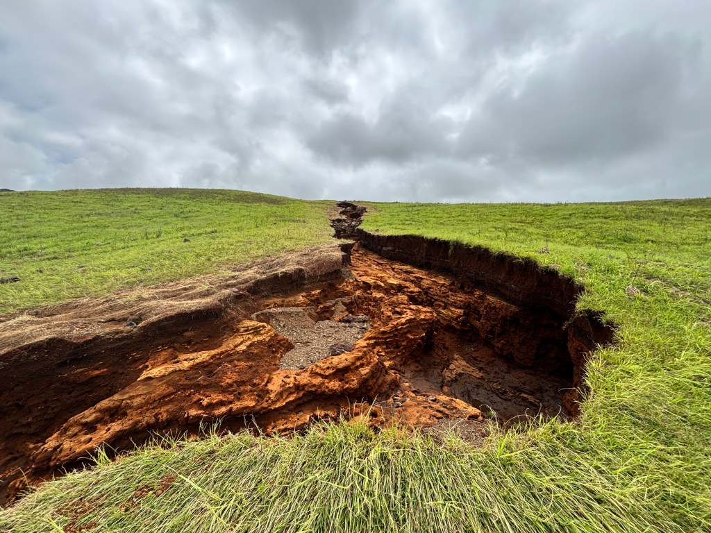
When Darryl Oliveira, the county’s acting civil defense administrator, flew over the area with Mayor Kimo Alameda the day after the storm, he noticed the vast scars the water had left on the ground below.
“There was definitely enough water that it was exceeding the traditional capacity of the streams. It wasn’t caused by a manmade issue, it was just the sheer volume of rainfall we were getting,” he told Civil Beat.
Concerns that a dam breach or infrastructure failure caused the damage in Nāʻālehu is understandable. The Wahiawā Dam nearly breached on Oʻahu during the Kona low storms in March, threatening the lives of several thousand residents downstream, and North Shore residents are currently suing the city and Dole for failing to maintain the nearby Kaukonahua Stream.
There are no ever-flowing rivers or streams in the region but the mountains of Kaʻū are filled with natural springs, tunnels and a gravity-fed system of flumes that carry water downhill when it rains. These water systems are far above the towns, so they remain a mystery to most residents. And that lack of visibility may be part of what led some outspoken residents to suggest that flooding was caused by a system failure.
The only two sizable bodies of water in the area are the Keaīwa Reservoir, which sits northeast of Pāhala on land belonging to the Edmond C. Olson Trust, and a smaller catchment pond on the tea farm owned by Eva Liu of Kau Royal Hawaiian Coffee & Tea.
The Keaīwa Reservoir has been empty since the earthquake that hit the island in May. According to Oliveira, it was empty prior to the storm. The spillway was left open so it wouldn’t fill with whatever rainfall accumulated, he added.
Oliveira also told Civil Beat that the smaller pond on Liu’s land appeared intact after the storm when he flew over it after the storm.
John Cross, senior land manager of the Olson Trust, which owns the Kaʻū Coffee Mill and manages 10,000 acres of land north of Pāhala, also rode a helicopter over the flooded area and saw the intact reservoir on Liu’s land. Cross, who has been managing land in the region since the 1990s, said that the reservoir’s spillway — a structural safety device used to release excess water in a controlled way — had released “vast amounts of water,” as it was designed to do to prevent rupturing, and there was no destructive erosion visible.
Paul Alston, an attorney and Olson trustee, was also on the helicopter and took several photos.
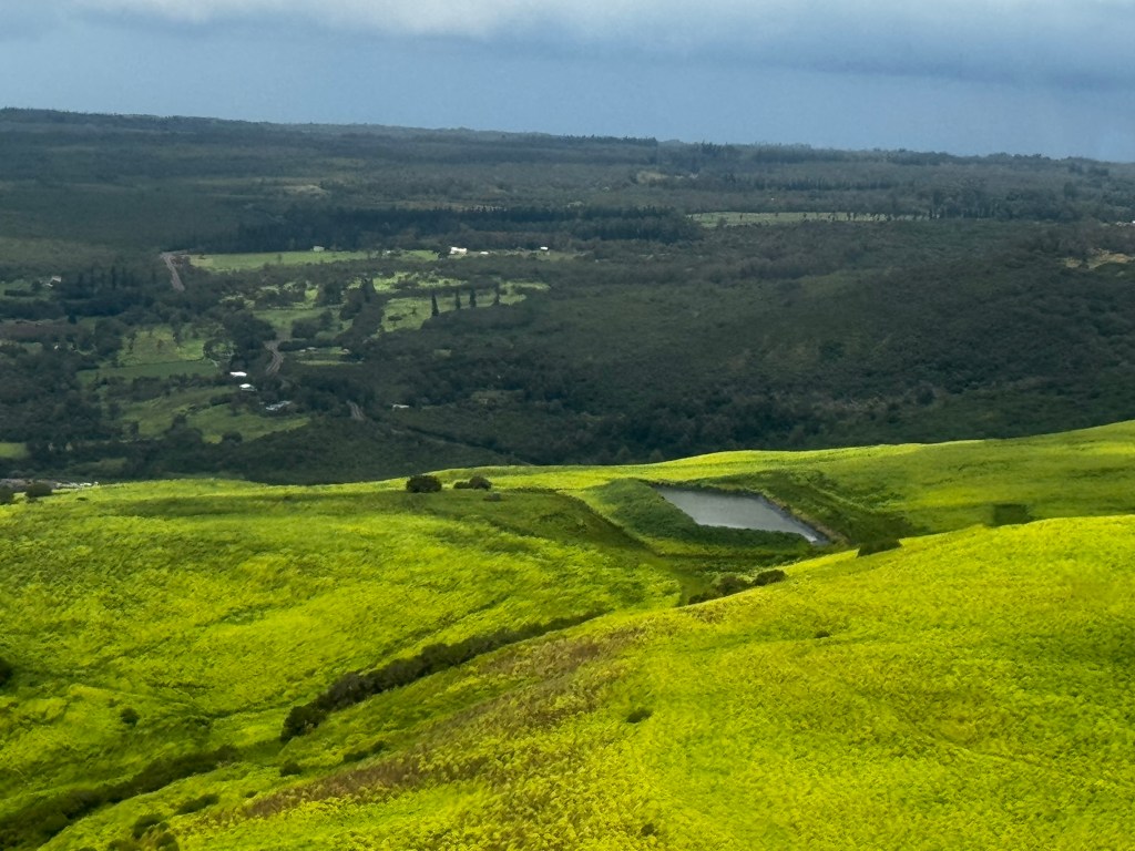
Eva Liu responded to the rumors by sharing yet another set of photos dated Aug. 19 that show the reservoir full. Liu didn’t respond to Civil Beat’s request for an interview.
Questions have also arisen about earthen holding pools in the area behind Liu’s land, but multiple experts said that those don’t appear to exist.
The Hawaiʻi County Department of Water Supply manages two water tunnels — the Hāʻao Springs and Mountain House tunnels — that provide drinking water for the region. Kawika Uyehara, the department’s deputy director, told Civil Beat that there is no such thing in that region.
“At each of those sources, we have a 5-foot by 5-foot concrete collection box. It just captures the water and then it pipes it to our system,” said Uyehara. “They hold 50,000, maybe 100,000 gallons.”
When he flew over the tunnels last Wednesday, he saw both structures intact. The flood water broke the department’s transmission lines that send drinking water to the communities below.
Plants May Have Formed A Dam
Data from the University of Hawaiʻi’s Hawaiʻi Mesonet weather-monitoring network shows the outer bands of Hurricane Lala unleashed torrents of rain over the Big Island during the evening of Aug. 15. Overall, 24 inches fell in Nāʻālehu that weekend, including 4.4 inches of rain in a single hour — the record across the state that weekend.
“It was an incredible amount of water, and this was seen all across Kaʻū,” Cross said.
The water jumped over the edges of existing waterways and channels, he said, and fell “where water never flowed before.” The rain expanded the river channels to “three or four times their previous width, and right down to bedrock, to the pāhoehoe,” he added.
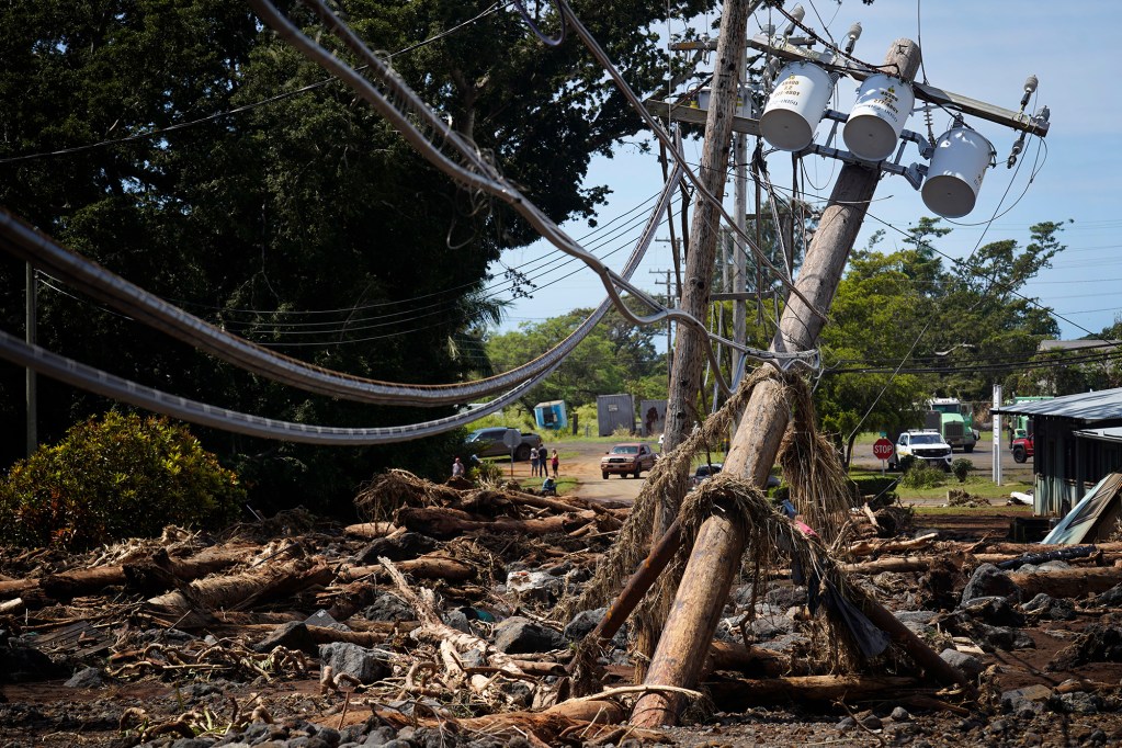
Multiple people have commented on the loud noise that could be heard in Nāʻālehu right before the wall of water, debris and mud came gushing down Kaʻalaiki Road and into the town’s cemetery.
A Hawaiʻi County employee living in the town later described it to Oliveira: “All of a sudden this very loud thunderous type of a sound, and then within minutes very high water coming through, almost like a flash flood.” But rather than a reservoir bursting, he said, it might have been “vegetation creating its own dam.”
Conservation ditches or berms were installed all across Kaʻū by the sugarcane plantations back in the 1970s and ‘80s. Berms are raised barriers that redirect rainwater and slow its flow so that it’s more likely to soak into the ground. They’re designed to move water horizontally into the rivers and creeks in the area. If those berms hadn’t been there, Cross said, the flooding would have been worse.
The areas around the berms can get clogged with invasive plants and downed trees. In an interview with Civil Beat, DLNR’s section head for flood risk management, Edwin Matsuda, said he and other staff members used satellite imagery to search for a burst dam or breach of some kind and didn’t find evidence of one above Nāʻālehu.
“We do show a grove of trees, north of those drainage ways, and we’re wondering if some debris clogged up some of the drainage ways, and then with the extreme amount of rainfall it might have broken loose,” Matsuda said. “We’ve seen that happen in other areas, like in Mānoa.”
Bobby Camara, a longtime employee of Hawai‘i Volcanoes National Park and a retired naturalist, told Civil Beat he found the theories about the ruptured reservoir distracting from more pressing issues. He pointed to invasive fast-growing albizia trees and cat’s claw vine, which can get tangled up together and block water from moving across the hillside at a consistent rate.
“Another issue in Kaʻū is that it’s young,” Camara said. “It doesn’t have deep valleys or gulches, so the water very quickly will overflow a shallow stream bed. When it overflows, it knocks down the guinea grass, which covers the soil, and doesn’t let too much of it percolate.”
Managing For Native Forests, Not Invasives
As people in and around Nāʻālehu will face difficult decisions about whether to harden the landscape, build new infrastructure to prevent flooding, and where to rebuild, Camara said he’d like to see more land management decisions made by people who are on the ground, observing how the natural world responds to climate stressors, and worries that bureaucrats in offices are missing key indicators.
“Everybody throws up their hands at invasive species,” he said.
The simultaneous rebuilding of native forests is key, he added, even if it’s not a fast solution. Those complex ecosystems act as sponges that retain and slow down water as it moves from mauka to makai, and help more of it enter the soil, before eventually restoring groundwater.
Kelsea Heider, a conservation planner with Kona Soil and Water Conservation District, said that prioritizing re-establishing a continuous band of native forest is one of the most important things local and state-level agencies can do to prevent or reduce flooding on Hawaiʻi island — but it has yet to be done in earnest.
“Native forests are particularly important because they are 100% suited to this environment and they have adapted to exist in our very shallow soils,” she said, noting that effort will require collaboration among landowners.
As Camara sees it, the most viable solution is the traditional kīpuka model, where natives are planted together in an intentional oasis. “Plant a little family of plants: ʻōhiʻa, māmaki, ‘uki’uki, ‘aʻali’i. Stuff like that grows relatively fast,” said Camara. “Put out a bunch of kīpuka, and then care for them, and with time, and we’re talking generations, those kīpuka will grow, enlarge and merge.”