
Hawaii Volcano Lava Flow: ‘Feel the Heat’
In 2014, Civil Beat photographer Cory Lum captured the slow-moving molten river of lava on a flyover.
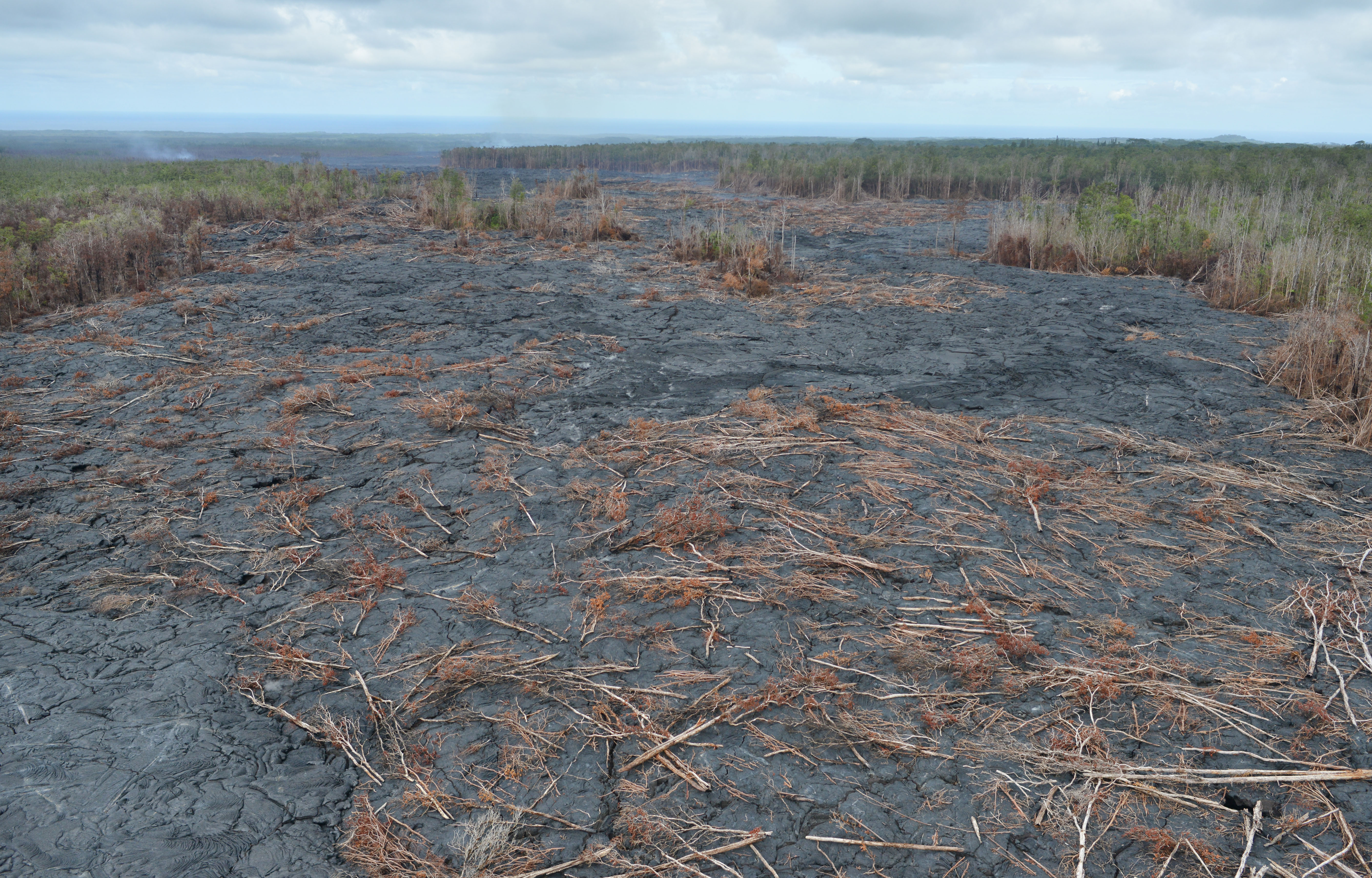
The molten river of lava flowing from Kilauea volcano continued its slow advance toward Big Island homes in the community of Pahoa on Wednesday.
Civil Beat photographer Cory Lum caught a helicopter ride above the scene and captured these photos.
Lum said there was a strong odor of sulfur in the air, even several hundred feet up.
And with the aircraft’s doors off, “You could actually feel the heat coming up,” he said.

Cory Lum/Civil Beat
U.S. Geological Survey scientists with the Hawaiian Volcano Observatory reported that the flow — known as the June 27th flow based on the date it began — was proceeding at about 11 yards an hour and was expected to cross Pahoa Village Road sometime Thursday. It is about 55 yards across.
Officials have blocked the public road and are allowing only local traffic. The news media is also being prevented from entering the area via the road. The USGS is posting photos and video on its website.

Lava stopped before covering gravestone markers near Pahoa.
Cory Lum/Civil Beat
Highway 130 is also close to the lava’s path, about 850 yards away as of Wednesday afternoon.
Rainy weather on Wednesday did nothing to dampen the fires and smoke that accompanied the 2,000-degree lava. A shed was the first structure to burn and a large pile of tires smoldered.
KITV reported smoke was causing some residents to worry about air quality and respiratory problems. People were stocking up on face masks, the station said.
Lava has been actively erupting from Kilauea since 1983 — more than 30 years.
The current flow has been advancing for the past four months as residents kept a wary eye on it even as tropical storms blew through the same area earlier this summer.
Hawaii County Civil Defense officials have notified about a dozen residents downslope of the flow to evacuate, and as many as 50 homes are reported to be in the path of the lava.
Some Hawaii officials criticized President Barack Obama for being slow to issue a presidential disaster declaration, something Gov. Neil Abercrombie requested nearly a week ago. A declaration would allow local officials to beef up response efforts, they say.

Molten lava breakout near Wednesday’s flow.
Cory Lum/Civil Beat
Meanwhile, U.S. Rep. Tulsi Gabbard spent much of Wednesday on the ground and in the air, touring the affected area with Hawaii County Mayor Billy Kenoi. Gabbard’s office said they flew the path of the flow from the vent to the tip and then walked from Pahoa Town to the edge of the flow where lava had destroyed part of a field of macadamia nut trees and was about 100 yards from the property’s home.

Cory Lum/Civil Beat
Cory Lum/Civil Beat
Watch a USGS video of Kilauea lava:
