
Scientists Unveil New 3D Maps In Race To Save Hawaii Coral
UPDATED: Researchers are using the new aerial mapping techniques to better understand what’s happening to Hawaii’s coral — and how to better protect it.
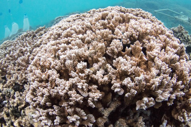
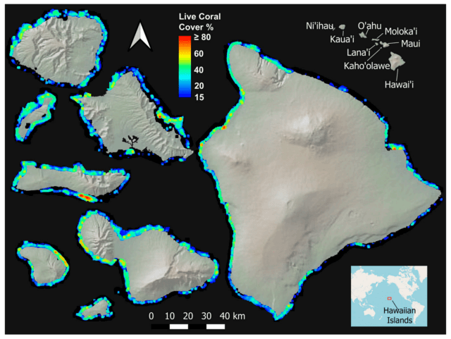
In the fight to protect Hawaii’s dwindling coral reefs, researchers on Monday released the results of a new aerial mapping technique that show where the tiny marine animals have managed to thrive — and where they’re in trouble — across the eight main islands.
Their surveys, done with 3D images of the seafloor taken from planes loaded with heavy gear, showed that no more than 12% of Oahu’s reefs are currently populated with coral.
There was probably three times as much coral along Oahu’s shores 200 years ago, said Greg Asner, who directs the Hilo-based Arizona State University Center for Global Discovery and Conservation Science.
But nearshore development, poor water quality, excess fishing and warming sea-surface temperatures linked to climate change have all taken their toll. They’re “the reason why Oahu is in bad shape,” said Asner, who led the “laser-guided imaging spectroscopy” effort in 2019 and co-authored the report out this week.
However, the images also showed offshore refuges where abundant coral has survived amid modern challenges and ought to be protected, such as Kiholo Bay on Hawaii island, plus other areas where it could be restored using coral out-planting methods commonly used elsewhere, Asner added.
Generally, the new aerial method represents a big leap forward in coral research that could help guide Hawaii policymakers with the most effective choices to protect and restore coral, Asner said.
That includes identifying places where the effort simply wouldn’t be effective or worth it given limited funding and resources, even if that’s not popular, he added.
“I think that any measurements that we have available to drive home to people the urgency and severity of the issues with our reefs is helpful,” said Rep. Nicole Lowen, who chairs the state House’s Committee on Energy and Environmental Protection.
Big decisions on how to better manage the ocean are “not without controversy” among the public and her fellow decision-makers in power, Lowen said, “hopefully this helps.”
The ASU report found water depth and wave power to be the top two factors determining the presence of coral. But the next biggest factors, including development, water quality, surface temperature and non-commercial fishing, were all caused by human activity.
Of the eight main islands, the Big Island had the largest percentage of coral living on its reef at just 17%, according to the report.
But where human activity is a big culprit to the coral’s absence on Oahu, geology plays a large role in its absence on the Big Island, Asner said. Much of that island’s hard-bottom reef is still too young geologically to support coral.
Kauai, meanwhile, showed little coral cover because it’s geologically older and its shores are so sandy, where coral can’t grow, Asner said.
The report says Hawaii was a good place to research coral because conditions vary so widely across the islands, both in terms of their human development and their geologic age.
Researchers have already done another aerial survey with the new technique in 2020 to assess the damage to coral from a recent prolonged heatwave. They’re still processing the results. Overall it was a “mild” bleaching event, but some areas did see severe damage, Asner said.
The research is mostly funded with philanthropic dollars, he added. Going forward, the aerial mapping should only be done after a major event such as a heatwave or hurricane, Asner said.
Asner said his team and his state and federal partners expect to have the new imagery and data available for public review on the website Hawaiicoral.org in the next couple of days.
Read the full study:
