
New Coral Disease Forecast Tool Shows High Risks Of Summer Outbreaks In Hawaii
The online system can give marine managers across the Pacific better data to act on as climate change intensifies the problem.
Coral researchers in Hawaii recently developed a new early warning system that forecasts how likely it is for two common diseases to afflict those vital marine animals in the Pacific, and it already shows a strong chance of outbreaks across the Hawaiian archipelago this summer.
The online tool, dubbed the “multi-factor coral disease risk,” forecasts a high risk of what are called growth anomalies to hit coral colonies on the windward side of Hawaii island, as well as across Maui and parts of Oahu and Niihau through August.
That risk of growth anomalies drops significantly along the Big Island by September, according to the tool. However, during that same month it forecasts a higher risk of the other common disease, called white syndrome, in various parts of the islands.
The warning system also forecasts coral disease in the Northwestern Hawaiian Islands, as well as Australia’s Great Barrier Reef, Guam, the Northern Mariana Islands, American Samoa and a vast ocean area known as the Pacific Remote Islands.
The goal, researchers say, is to give regional groups and government agencies a tool to make better management decisions for the marine areas they cover as climate change causes coral disease outbreaks to occur more often.
“Diseases are a natural part of ecological seasons, but we are seeing coral diseases occurring at a greater frequency and severity because of climate change, and that was the motivation for developing the tool,” said Megan Donahue, interim director at the University of Hawaii Manoa’s Hawaii Institute of Marine Biology.

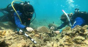
In Hawaii, federal managers at the National Oceanic and Atmospheric Administration and state managers with the Department of Land and Natural Resources can plan their management of certain nearshore areas with vulnerable coral colonies using the forecast tool, she said. Community groups can be on the lookout for signs of disease at the coral reefs they steward.
The new disease forecasts rely largely on existing ocean temperature forecasts — but it also uses other data such as water quality, nearby human population and land uses and coral colony sizes.
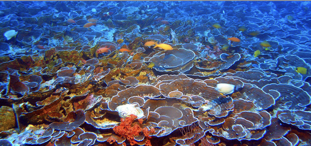
Corals afflicted with growth anomaly have tumor-like growths that hurt their reproductive output, while corals with white syndrome have patches of white that spread and cause the animals to shed their tissue, Donahue said.
Currently, there aren’t any great tools to quickly stop those diseases, Donahue said. Still, marine managers can take actions to reduce their harm and spread such as prohibiting scuba diving and diverting land runoff from high-risk areas, she added.
DLNR’s Division of Aquatic Resources has a response team for local coral bleaching events and that team could also respond to potential disease outbreaks flagged by the forecast, Donahue said. DAR representatives weren’t available to discuss the tool Thursday.
The forecast tool comes online after parts of Hawaii endured severe coral losses in the past decade, following prolonged heat waves in 2014-2015 and in 2019, with only some recovery.
Research has shown that West Hawaii, Maui and parts of Oahu saw steep losses in coral after those heat waves, with some spots in West Hawaii seeing declines as large as 50%, according to Mary Donovan, an associate researcher at HIMB who studies coral cover loss.
The areas that saw the worst declines were places that saw higher levels of wastewater pollution from sources such as cesspools and overfishing, Donovan said.
Civil Beat’s coverage of climate change is supported by The Healy Foundation, Marisla Fund of the Hawaii Community Foundation and the Frost Family Foundation.
Civil Beat’s coverage of environmental issues on Hawaii island is supported in part by a grant from the Dorrance Family Foundation.
