Navy Hopes Native Hawaiian Outreach Will Help Keep Kauaʻi Missile Base Land
Comments on a draft report from the Navy and NASA are due Aug. 7.
Seeking to avoid pitfalls that have stalled other military negotiations, the U.S. Navy is reaching out to Native Hawaiians and promising to assess cultural impacts in its bid to retain use of land on Kauaʻi needed to support operations at the Pacific Missile Range Facility.
Officials also have proposed a Plan B that would include purchasing a smaller subset of the lands that house instruments needed to track targets and aid in global navigation systems.
Either of those options will require approval from the state land board on an environmental study that is in the drafting phase. That has proved a major hurdle in efforts by the U.S. Army to keep training areas on Oʻahu and the Big Island. The Navy hopes its proactive outreach will help it avoid that fate.
The Army was criticized for failing to reach out to descendants of the land and for not providing enough information for the state to conduct what is called a Ka Paʻakai analysis to assess the cultural impact of the military’s activities.
Named after a state Supreme Court case in which Native Hawaiian groups challenged the reclassification of conservation lands, the analysis requires the state to evaluate archaeological and cultural sites in the area, the impact of the Navy’s use of those lands and how the state can mitigate those impacts.
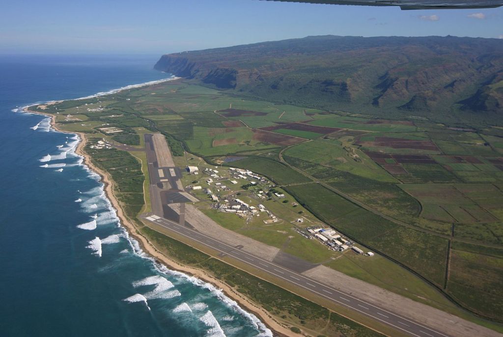
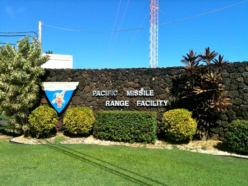
The stakes are high. The Pacific Missile Range Facility, a key training site for defense technologies and high-end weapons systems, sits on 1,000 acres already owned by the federal government. It houses air strips, base facilities and missile launch sites near Kokole point and on the north end of the base near Barking Sands beach.
The land under negotiation includes the ridgelines of western Kauaʻi mountains where radar systems and other tracking equipment needed to help operate the missile base are located. The Navy also leases land for storage facilities near the base.
The Navy and NASA, which operates the Kōkeʻe Park Geophysical Observatory, released a draft environmental impact statement on June 20 and recently concluded a series of meetings on Kauaʻi to solicit feedback. Comments on the report are due Aug. 7.
The Department of Land and Natural Resources rejected similar studies filed by the Army earlier this year for training grounds on Oʻahu and the Big Island, noting deficiencies in the Army’s cultural assessments and outreach efforts to lineal descendants of the affected areas.
The Army’s environmental report for its leases also either didn’t have the information to conduct the Ka Paʻakai analysis or said that information would be provided later.
Meanwhile, Army Secretary Daniel Driscoll said recently that he wants to resolve issues with the Army’s leases in Hawaiʻi in the coming months after the land board’s rejection of the Army’s environmental reports threw that process into limbo.
All of those lands, including those the Navy seeks to retain on Kauaʻi, were leased to the military in the 1960s for just $1.
Negotiating ‘In Good Faith’
As part of the drafting process, Navy officials said they interviewed Kauaʻi residents who have ancestral ties to the lands in West Kauaʻi and spoke to representatives of the Aha Moku, a Hawaiian advisory council created by the state.
Kane Turalde, the Aha Moku representative for Kauaʻi, said he has a good relationship with the Navy.
Over the years, Turalde said he’s tried to educate federal officials on both the history of the lands in West Kauaʻi as well as the families that owned the land before U.S. annexation that followed the 1893 overthrow of the Hawaiian Kingdom.
He believes those lands that the Navy now occupies have been stolen, but he said he’s willing to set aside that issue so long as the Navy doesn’t expand its footprint on the Garden Island.
“I told them ‘I’m here to work with you guys in good faith’” he said. “Stay on the correct track and don’t go beyond.”
After watching the Army’s hearings before the land board, the Navy decided that it would include information for that analysis in the final environmental report, Navy project manager Kerry Ling told trustees of the Office of Hawaiian Affairs last week.

Such an analysis is necessary for uses of land at the scale the military is asking for, said Davis Price, a Hawaiian activist and lawyer.
“I would think they would attempt to avoid the same issues the Army has faced,” Price said.
Price said he hopes state leaders consider the military’s broader impact on Hawaiʻi’s environment, economy and housing market in the negotiations with the Navy and other departments.
“The value of those leases has to include the impacts the military has in Hawaiʻi generally,” he said.
New Agreements Proposed
The Navy proposed a couple of options for retaining land near the missile base, which is the third-largest employer on the rural island.
It could enter into new “real estate agreements” — leases and easements that allow it to use or traverse state-owned land. Most of those leases expire between 2027 and 2030.
It also has weighed the possibility of purchasing up to 700 acres of state lands.
The state land division in DLNR plays a pivotal role in the leasing process by making recommendations to the land board. It recommended the rejection of the last two environmental reports from the Army.
In a letter to the Navy’s consultants, state land administrator Russell Tsuji outlined more than two dozen points seeking clarity on the environmental report.
Tsuji asked for more information on what exactly the Navy tracks from the missile base and any efforts to clean hazardous or toxic material.
He also asked for more information on surveys and cultural consultations, findings of iwi kūpuna near the base, and the methodology by which impacts to water resources were evaluated.
If the state decides not to renew the leases or negotiate with the Navy, the result would be detrimental to its operations, the report said.
While it would still have the main missile base, the Navy is worried it would lose the tracking equipment on the Mākaha Ridge and in the Kōkeʻe park that all sit entirely on state lands.
Without those facilities, the range’s “training and testing missions would be unsupportable,” the report said.
The report also said the Navy would not be able to continue ongoing preservation efforts if it loses use of state lands.
Cultural Impact Concerns
A cultural impact study filed with the draft report found eight new archaeological sites in the Komohala Ridge area, near some of the Navy storage facilities. The report recommends preserving those sites in-place.
Those sites are important for studying how Hawaiians settled on Kauaʻi long ago, according to the study.
The draft environmental report also briefly mentions the impact of sea level rise on operations. The report includes a map that shows many of the roads leading to the base inundated with a 3-foot rise in sea levels, which is anticipated by the year 2100.
Much of those lands are used by Kauaʻi farmers as well as the Navy for storing equipment and munitions. The Department of Defense is funding efforts to create a system of ditches in the nearby Mānā Plain to combat the effects of sea level rise.
Civil Beat’s coverage of climate change and the environment is supported by The Healy Foundation, the Marisla Fund of the Hawai‘i Community Foundation and the Frost Family Foundation.