Traffic Tsunami During Evacuation Offers Lessons For Future
Cars were backed up for hours, and miles, on Tuesday in Honolulu as residents responded to alerts by jumping in their cars. Experts say there are other options.
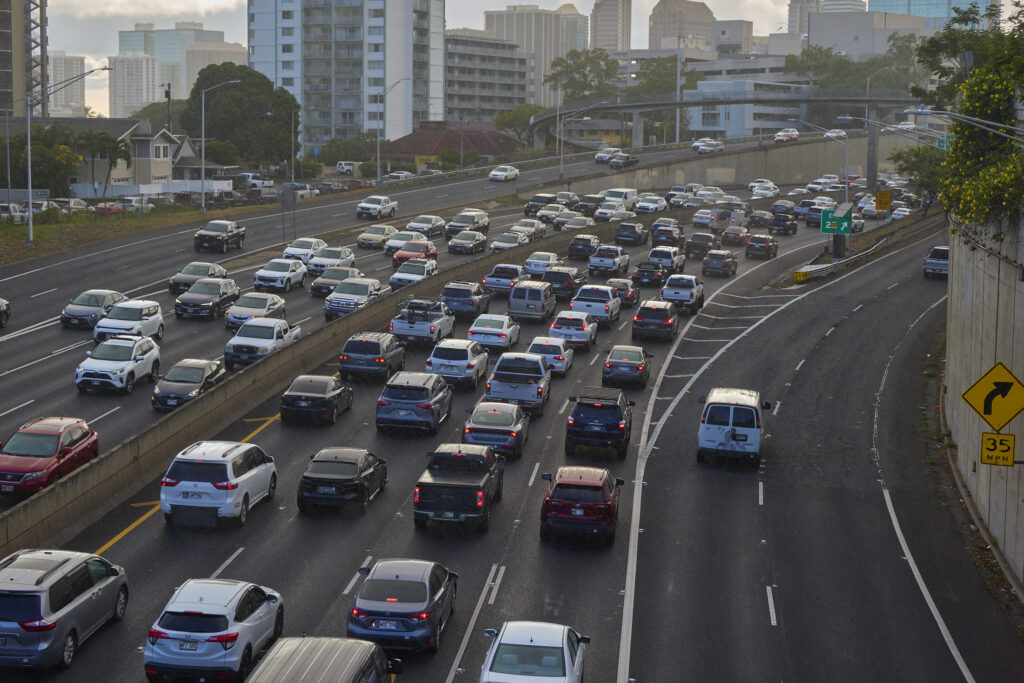
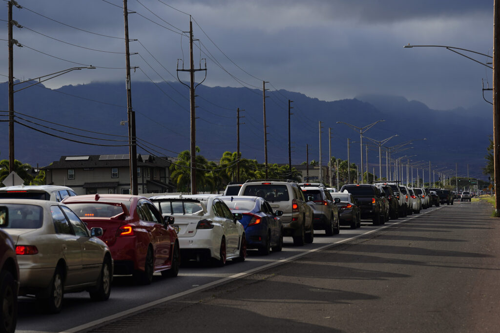
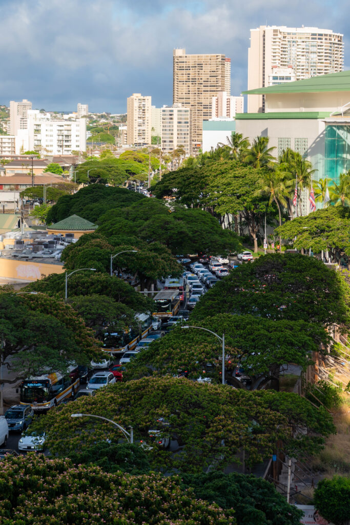
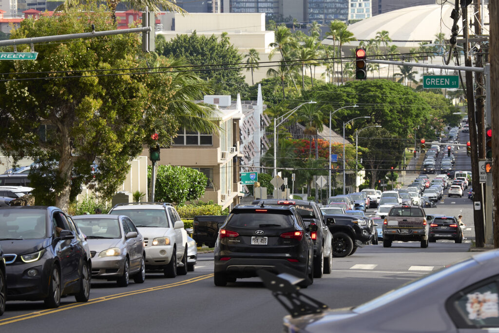
Traffic going barely anywhere.
From the general public to disaster management experts, that was the most visible takeaway from the hours during which a tsunami warning was in effect Tuesday and people fleeing in their vehicles clogged the roads.
“The major concern, obviously, is the gridlock,” said Karl Kim, executive director of the National Disaster Preparedness Training Center at the University of Hawaiʻi. “We were very fortunate that it was not a more serious inundation event.”
Looking ahead, Kim said, Hawaiʻi’s emergency management authorities need to deliver the message that there are ways to evacuate other than in your own car and to your own home. In dense urban areas like Waikīkī, that means going to the upper floors of tall buildings is frequently the best option — what experts term “vertical evacuation.” In more rural areas, that generally means heading inland to higher ground.
The first widespread tsunami warning blared out from the state’s Emergency Management Agency at 2:44 p.m. to every cellphone in Hawaiʻi, urging people to leave coastal areas, and move to higher ground or inland immediately. It said nothing about heading to tall buildings.
The first suggestion that people who were able to, should evacuate to at least the 4th floor of any building 10 stories or taller came nearly an hour and a half later, at 4:11 p.m., and then only to the roughly 100,000 subscribers to HNL Alerts, an opt-in system run by the City and County of Honolulu.
That’s too late, Kim said, and reaches only a small segment of the population. And it’s a human tendency not to act immediately.
“People delay taking action, they confirm the info and typically seek advice or hesitate,” he said. “Then they decide to act but they may not have the assets or capabilities. … By the time people do act, the roads are congested.”
Taking Cars Off The Road
While traffic in Honolulu had mostly cleared by the time the first wave was expected to hit a little after 7 p.m., that followed hours of traffic backup — and a lot more advance notice than might be likely in many natural disasters.
Evacuation doesn’t have to mean driving away in a car anyway, said Molly Pierce, who leads communications for the Honolulu Department of Emergency Management.
Rather than sit stuck in traffic for hours, Pierce said, many people could have been safer walking or biking 20 minutes inland. That would have meant fewer cars on the road.
“I think a lot of people don’t understand just how short of a distance they have to go sometimes,” she said, especially in the urban core. “We have people evacuating all the way to the back of Mānoa, when really they just need to get above the freeway, or wherever it may be.”
Vertical evacuation is the department’s “strong preference” if possible, Pierce said, since it means fewer cars jamming the roads.
“Our cars are kind of an extension of ourselves,” she said. “But really, the car is the thing that holds you back sometimes.”
Pierce acknowledged that Tuesday’s gridlock necessitates more of a public awareness campaign about ways to evacuate other than driving.
“Our cars are kind of an extension of ourselves. But really, the car is the thing that holds you back sometimes.”
Molly Pierce, Honolulu Department of Emergency Management.
Those should include pressing TheHandi-Van, a public paratransit service for people with disabilities, TheBus and ride-share options into service more rapidly and widely to assist with evacuations, better traffic control measures, Kim said, and emphasizing how people can look out for one another.
“It’s about traffic flow but also having the transport assets to move people efficiently,” he said. “This requires a whole community approach that involves law enforcement, public transit, ride-share and neighbors helping neighbors.”
A Learning Opportunity
Kim and other observers said the state and local governments did a lot of things right in response to the tsunami threat, but taking stock now offers an opportunity to make improvements to disaster preparedness in Hawaiʻi.
“This is a sign that we have to invest more in training, education and communications,” he said.
That’s what Sonoma, a California county of about 500,000 residents an hour north of San Francisco, did after a devastating 2017 firestorm burned more than 5,600 homes and killed at least 24 people.
The county invested heavily in early warning systems, creating a two-person division responsible solely for managing the task of alerting residents to disasters, keeping them updated and issuing evacuation orders — and running weekly tests to bug-proof the process, said Jeff DuVall, director of the county’s Department of Emergency Management.
This is what the traffic looks like.
— Danielle Tucker (@dt808traffic) July 30, 2025
Please be patient. I know it's really hard. But it's better for everyone, and you.
NEW: Likelike Hwy is now OPEN in the Honolulu bound direction. The work suspended for the rest of the day. #hitraffic pic.twitter.com/70F8dEblap
While Sonoma County had relied on an opt-in alert system in 2017, it subsequently adopted a policy of using a wireless alert system — the same one the state of Hawaiʻi used to issue its hourly tsunami warnings Tuesday — that reaches anyone with a cellphone in any geographic region. Officials also supplied National Weather Service radios to residents who live in areas without cellphone coverage.
The county’s office of emergency services conducts regular training exercises during which alerts are sent out, emergency vehicles run their sirens, and people who participate in the process as evacuees meet at rally points to debrief and give feedback.
“It creates a culture of awareness and ownership and accountability by individuals,” Sonoma County Supervisor James Gore told Civil Beat Wednesday.
In 2017, about 100,000 people ultimately evacuated the wildfire. In 2019, when another, larger fire swept into Sonoma County, the revamped evacuation system helped lead to twice that many evacuating, with no fatalities, DuVall said.
During the second evacuation, law enforcement officers also metered traffic entering the region’s major highway to limit gridlock, and turned a major thoroughfare out of one large section of the county from a two-lane highway into a one-way route.
Much of that approach had been strategized in disaster planning work that took place between the two wildfires, said Mark Heine, who was the Sonoma County Fire District chief during the 2019 Kincade fire.
“That is always a challenge, particularly in the communities that have limited access and egress, limited ways in and out,” Heine told Civil Beat. “The most effective tools to deal with that are pre-planning that and pre-planning it between fire, EMS and law enforcement.”
Less Warning, Different Messages
Traffic control strategies such as adjusting the timing of traffic lights and rerouting one-way streets could also be considered in Hawaiʻi, said John Pennington, deputy director of the University of Alaska at Fairbanks Center for Arctic Security and Resilience.
“I think there could be a real deep analysis of where that might work,” said Pennington, who headed the Federal Emergency Management Agency’s Region 10 area — which includes Idaho, Washington, Oregon and Alaska — from 2001 to 2006.
Officials at the Honolulu Emergency Operations Center did adjust traffic light timing to help unclog intersections, according to city Deputy Director of Transportation Jon Nouchi. Traffic cameras helped them see which intersections needed the most help as they prioritized mauka-bound traffic.
Nouchi said he understands the inclination to drive rather than evacuate on foot, since cars offer a guaranteed personal space for people when evacuating in an uncertain situation.
“They’ll have almost like a mobile home base,” he said.
Still, he acknowledged the traffic that results when thousands of people think that way. If a future tsunami were to strike with less warning, Nouchi said, the city’s messaging would likely say there isn’t time to drive anywhere, while urging people to evacuate vertically or on foot.
Some upcoming city projects aim to alleviate traffic in other ways.
City officials market their proposed pedestrian bridge in the middle of the Ala Wai Canal as an emergency escape route during tsunami warnings, and its overbudget and delayed — but growing — Skyline rail system aims to offer an alternative to sitting in H-1 traffic.
“It’s an asset that did not rely on the roads below, and so a lot of people did utilize Skyline yesterday,” Nouchi said. He’s still awaiting Tuesday’s ridership numbers, which the department posts to its website in monthly batches.
TheBus halted new trips at 6 p.m. and drivers were told to avoid inundation zones after that, but they were told not to abandon their buses and passengers.
“We did have a large gathering of Waiʻanae Coast buses … at the Nānākuli High School Cafeteria,” Nouchi said.
Roger Morton, the city’s transportation department director, said during a Tuesday evening press conference that police officers were directing traffic along Oʻahu roads. However, many drivers reported none to be seen, adding to the chaos.
“You have very limited road access because the water is a natural barrier… and you’re naturally absolutely going to be boxed in with your options.”
John Pennington, former Region 10 FEMA director
Asked where police officers were stationed to direct traffic and how many were deployed, Honolulu Police Department spokesperson Alina Lee referred questions to the city and state transportation agencies. Nouchi, from the city, and spokesperson Russell Pang, from the state, said their departments don’t have that information.
Pennington, the former FEMA official, lives in Fairbanks, Alaska, but was vacationing with his family in Haleʻiwa when the first tsunami alerts went out and quickly relocated to a Kapolei hotel. He noted that a state made up of islands faces particular challenges.
“You have very limited road access because the water is a natural barrier… and you’re naturally absolutely going to be boxed in with your options,” he said.
Given that context, he said, overall, the evacuation and the process of keeping the public informed went very well.
“There’s always room for improvement,” he said, “but I’m going to stand by the fact that this state, in all of my years of doing this, I’ve not seen it done this effectively given the circumstances and the magnitude.”