
Tsunami Prediction Has Gotten Much Better. Hawaiʻi Just Needs More Data
Specialized buoys can monitor waves on the seafloor. But there are few sea-level stations between Asia and Hawaiʻi to test the accuracy of the forecast.
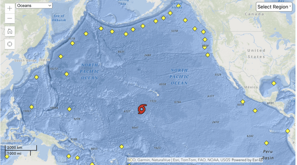
An earthquake jolts the seafloor somewhere in the Western Pacific. The resulting wave begins its journey across the ocean at the speed of a jet, to Hawaiʻi and beyond.
The models for whether the disturbance will result in a tsunami, and how big it will be, have become far more sophisticated over the years.
The problem, especially in Hawaiʻi, is that there is still not enough data to fine-tune the predictions in a way that might avoid wholesale evacuations of the tsunami zones, instead pinpointing areas along the coast that can expect an impact.
Consider a wave like the one that struck Tuesday after an earthquake off the eastern coast of Russia.
Specialized buoys deployed by the U.S. and other nations can measure its size as it moves across the bottom of the ocean. But what will that wave look like at the surface when it hits coastlines, where people live?
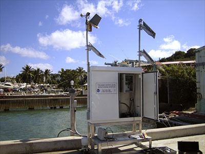
For that, one needs a station with a tide gauge at sea level to measure the wave’s size.
The only coast water-level stations between the Western Pacific and Hawaiʻi are in Midway Atoll and French Frigate Shoals. Those stations give scientists a chance to gauge the accuracy of the models for how the tsunami will play out in real life and adjust their warnings, said Laura Kong, director of the International Tsunami Information Center in Honolulu.
But when waves hit French Frigate Shoals, they are an hour or less from Kauaʻi — too late to issue or adjust tsunami evacuation plans. And if a warning has already been issued, emergency officials are reluctant to cancel it unless they are absolutely certain nothing is going to happen, Kong said.
“The technology is better,” she said. “The science and models are better. The computers are better, so we can make better predictions. But we still lack the confirmation between anywhere and Hawaiʻi, because we don’t have any data” beyond those two stations.
Other initiatives, however, may help fill data gaps. The Biden administration in 2024 set aside $30 million to modernize and replace the specialized buoys — called Deep-ocean Assessment and Reporting of Tsunamis Ocean Observation System.
The money, which has so far survived federal budget cuts, would be used between now and 2028 to replace 20-year-old equipment with buoys better able to forecast the intensity and arrival times of tsunamis.
And a number of nations are working with telecommunications companies to add sensors to deep-ocean cables to detect and monitor deep-sea waves. This would greatly expand the monitoring network, at a lower cost than the DART buoys.
Even with all that, emergency officials still struggle with the question of whether or how to refine warnings so that fewer people are forced to evacuate.
One of the virtues of the current system is simplicity. You find your house on the evacuation zone map and either stay or go. Drawing lines within those zones on the fly could lead to confusion.
“I think that’s one of the central challenges,” Kong said.
Most Fatal Tsunamis Occur In Pacific
The stakes are high. The Pacific Ocean is more prone to tsunamis than any other sea basin, according to the United Nations Educational, Scientific and Cultural Organization, which coordinates tsunami warning systems and responses between nations.
That’s because of the so-called “Ring of Fire” — the subduction zones where one tectonic plate dives under another and the associated faults cause earthquakes.
Some 69% of fatal tsunamis occur in the Pacific, UNESCO says, most of the deaths occurring when the waves hit within a few hours.
About 700 million people live in low-lying coastal areas susceptible to such ocean hazards, UNESCO says, and this population is expected to grow to 1 billion by 2050.
Preparing for tsunamis took on greater urgency in 2004, when a magnitude 9.1 earthquake hit the island of Sumatra in Indonesia, killing 227,000 people in 15 countries. For those on the northwest coast of Sumatra, the wave of as much as 150 feet hit within 20 minutes.
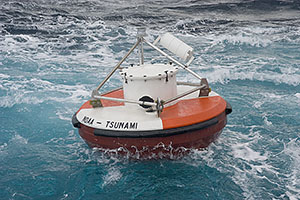
One of the major tools in predicting tsunamis has been the DART buoys. As of 2023, UNESCO says, 50 such buoys monitored conditions across the Pacific. This included a recent addition of 12 buoys near the Tonga-Kermadec Trench, which runs from New Zealand almost to Samoa, filling a gap in the warning network.
The DART buoys measure pressure changes at the ocean bottom caused by tsunamis. The National Oceanic and Atmospheric Administration runs 39 of them in the Pacific and other oceans. They must be regularly maintained or repaired, which can be a challenge considering their remote locations.
In May, one of them off of Kailua-Kona on the Big Island went adrift. They can be hard to service in winter seas, and some of them get snagged in fishing nets or ransacked.
In addition to DART buoys, tsunami predictors rely on sea-level stations, often on piers in harbors, generally meant to keep track of tides or to aid in navigation. It’s useful data, but the way the waves hit these stations may not give a good read on how they will behave when they strike open coastline, for instance, Kong said.
One promising idea is putting sensors at the junctions of undersea telecom cables to monitor pressure just like DART buoys do. Considering the growing number of such cables, the sensors could create a powerful network.
But adding the sensors may add 10% to 20% to the cost, and someone has to pay.
In Portugal, a telecom and government shared the costs, Kong said. One being considered in Vanuatu and New Caledonia would be funded with the help of the World Bank. But there are many logistics to work out, Kong said, such as who owns the data, how it’s shared and which country controls the waters where the cable is laid.
The advantage is that they cost nothing to maintain.
Japan, she said, has installed undersea cable with no telecom purpose, solely for earthquake and tsunami prediction.
“They’re dedicated systems because of the hazards, and the funding is available,” she said.
UNESCO reported in 2023 that money for tsunami preparation was tight among Pacific nations, especially during the Covid-19 pandemic. UNESCO itself didn’t have the money it needed to support what it considered critical measures.
Tsunamis don’t recognize borders, of course, so all the nations of the Pacific rely on each other’s systems for warnings.
In Hawaiʻi, emergency planners continue to talk about ways to refine the forecasts to pinpoint who, exactly, should evacuate.
Each event provides more historical data on what places are hit hardest, and which seem relatively protected. Maybe the evacuation order would be confined to one island and not the others, or certain parts of each island.
But what if a very particular order comes down — Lāʻie and Haleʻiwa, but not Kahuku?
“How confusing could that be to anyone who’s maybe in a panic, not getting the whole message, and then we’re drawing a line on the road?” Kong asked.
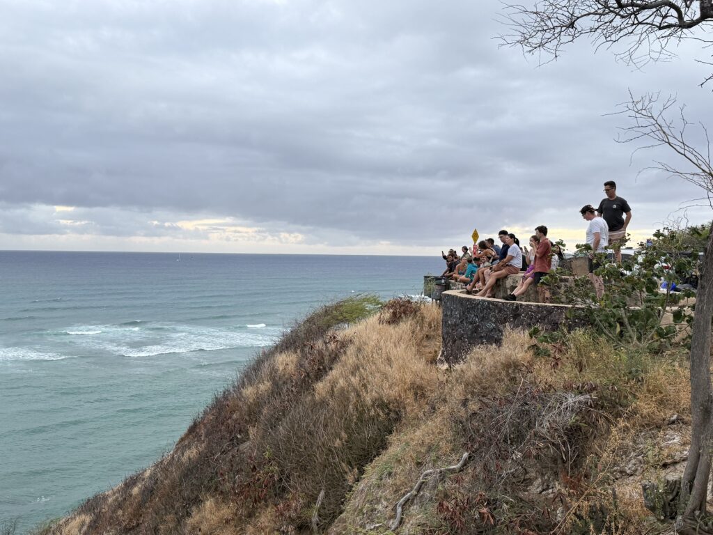
The simple alert system now in place, “seems to be working, and I think it more or less worked yesterday.”
